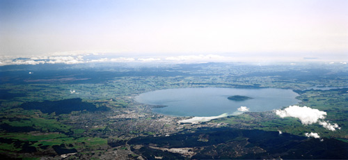
This photograph shows the Rotorua urban area and Lake Rotorua, with Mokoia Island at its centre. The general name for the area where Rotorua city now stands is Ōhinemutu. The name commemorates the explorer Īhenga’s daughter, who was murdered on the north-west shore of the lake. Īhenga set up a red-coloured memorial rock, referred to as Ōhinemutu, on the southern shore. Eventually the name applied to the wider area, which included the site of a village. The memorial rock stood for centuries before disappearing in the 1880s. It is said to have been broken up for road-building.
Using this item
GNS Science
Reference:
28747
Photograph by Lloyd Homer
Permission of GNS Science must be obtained before any use of this image.


Add new comment