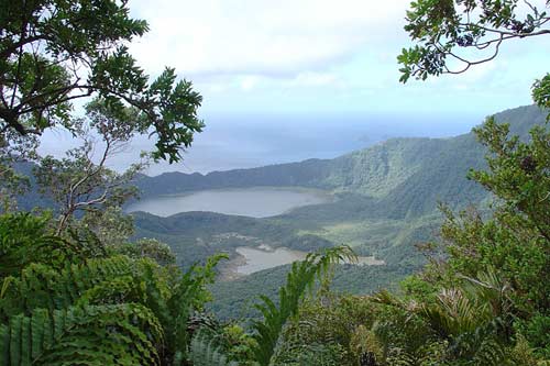
Raoul Island, the largest of the Kermadec Islands, is an active volcano that last erupted in 2006. A broad central crater (called the Raoul caldera) contains two lakes, both the sites of previous eruptions. Green Lake, in front, has hot springs. Vents in or near the lake have erupted several times in the last 200 years. Blue Lake, behind, is larger, and lies in an older explosion crater.
The island is covered in forest, mainly pōhutukawa and other broadleaf trees. Because of the subtropical climate, trees grow rapidly, and the damage from volcanic eruptions is mostly covered by vegetation within 20–30 years.
Using this item
Department of Conservation
Reference:
10057060
Photograph by Rebecca Stanley
This item has been provided for private study purposes (such as school projects, family and local history research) and any published reproduction (print or electronic) may infringe copyright law. It is the responsibility of the user of any material to obtain clearance from the copyright holder.


Add new comment