


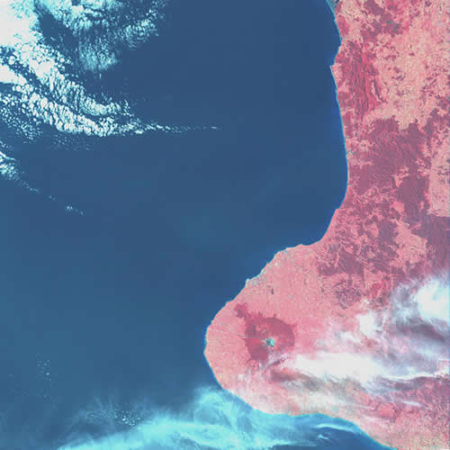
The data for this satellite image of Taranaki was recorded by Landsat 1 as it passed over New Zealand on 30 January 1974. The data consisted of wavelengths from four spectral bands – one green, one red, and two infrared. The native bush of Egmont National Park shows up clearly against the lighter pink of the cleared land in Taranaki.
Te whakamahi i tēnei tūemi
Landcare Research – Manaaki Whenua
© Copyright image. All rights reserved. Permission from Manaaki Whenua: Landcare Research New Zealand Limited must be obtained before the re-use of this image.


Tukunga
Satellite images are really
Jenny Watson (not verified)
28 o Pēpuere 2013
Tāpiritia te tākupu hou