


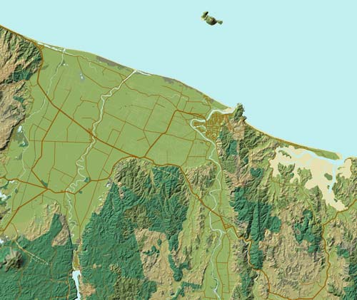
This digital image of the Rangitāiki plain in the Bay of Plenty was created using topographical data from Land Information New Zealand (LINZ), overlaid with information about the land and vegetation. It appeared in the book Landforms, a collaborative effort between scientist Les Molloy and Roger Smith of Geographx, a company specialising in three-dimensional representations of the land. Combining LINZ’s topographical data with other geographical information, along with developments in graphic software, has allowed Geographx to produce maps that are almost photo-realistic.
Te whakamahi i tēnei tūemi
Geographx
Cartography by Roger Smith
This item has been provided for private study purposes (such as school projects, family and local history research) and any published reproduction (print or electronic) may infringe copyright law. It is the responsibility of the user of any material to obtain clearance from the copyright holder.
Tāpiritia te tākupu hou