


")

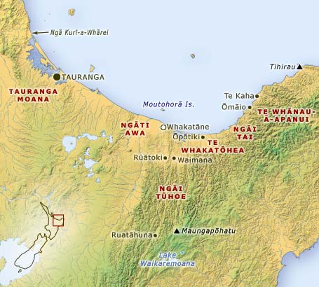
Muriwai, the sister of Toroa who captained the Mataatua canoe, placed a restriction along the coast when her two children drowned. The restriction ran from Bowentown in the west to Whangaparāoa in the east. This area has become acknowledged as the domain of the Mataatua confederation of tribes, of whom Ngāti Awa are one. This map shows the Mataatua territories.
Using this item
Te Ara – The Encyclopedia of New Zealand
This item has been provided for private study purposes (such as school projects, family and local history research) and any published reproduction (print or electronic) may infringe copyright law. It is the responsibility of the user of any material to obtain clearance from the copyright holder.

Add new comment