


")

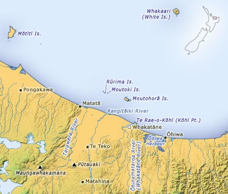
Within the domain of the Mataatua canoe, the Ngāti Awa people are to be found in an area centred on Whakatāne. This map shows the Ngāti Awa lands and some of the places of significance to the tribe.
Using this item
Te Ara – The Encyclopedia of New Zealand
This item has been provided for private study purposes (such as school projects, family and local history research) and any published reproduction (print or electronic) may infringe copyright law. It is the responsibility of the user of any material to obtain clearance from the copyright holder.
Add new comment