


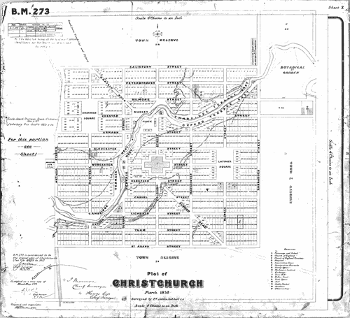
This original plot map of Christchurch was drawn up in March 1850, following the survey by T. Cass. It shows the predominantly English names chosen for the city’s streets.
Te whakamahi i tēnei tūemi
Canterbury Museum
Reference:
CMU1559/2
Permission of Canterbury Museum, Rolleston Avenue, Christchurch, New Zealand must be obtained before any re-use of this image.

Tāpiritia te tākupu hou