


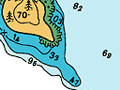
This is probably one of the most-used charts of New Zealand waters. Waitematā Harbour is the playground for thousands of sailing vessels and recreational fishing boats. The busiest shipping lane in the country also runs through it. Very large container ships, which need depths of at least 12 metres, must stay within defined channels or risk running aground. Many large ships rely on navigational instruments that use satellites; however, charts remain important for small vessels.
Using this item
Land Information New Zealand
Reference:
NZ5322
This item has been provided for private study purposes (such as school projects, family and local history research) and any published reproduction (print or electronic) may infringe copyright law. It is the responsibility of the user of any material to obtain clearance from the copyright holder.
Source: LINZ (not to be used for navigation)
Add new comment