


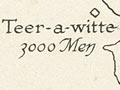
In 1851 the hydrographic survey of the New Zealand coast was taken over by Commander Byron Drury and the Pandora. Drury and his crew spent four years charting parts of the northern coastline, such as Kāwhia Harbour (1854). The surgeon on the Pandora, John Jolliffe, commented that while it was ‘no doubt interesting work for those actually employed on survey duties …for us lookers-on it is very tedious’.
Using this item
Alexander Turnbull Library
Reference:
MapColl 832.17aj/1854/Acc.13237
Permission of the Alexander Turnbull Library, National Library of New Zealand, Te Puna Mātauranga o Aotearoa, must be obtained before any re-use of this image.

Add new comment