Story summary
Wellington is New Zealand’s capital city, lying on the northern side of Cook Strait at the centre of the country.
Landscape
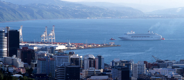
Hemmed in by hills, Wellington city sits on a beautiful harbour. Houses cling to the slopes and there is not much flat land. Running through the city is the Town Belt – a hillside strip of trees, parks and walkways. The rugged Remutaka and Tararua mountain ranges loom beyond the harbour.
Earthquakes
Wellington lies on three faults – lines of weakness in the earth’s crust. Many people live near the Wellington Fault, and there are frequent earthquakes. Most of the houses are wooden, and many city buildings have been strengthened.
Wellington wind
Famous for being windy, the city is often buffeted by strong gusts that are funnelled through Cook Strait. Landing at the airport can be very bumpy.
Māori history
Early tribes include Ngāi Tara, Rangitāne and Ngāti Mamoe. Ngāti Toa chief Te Rauparaha invaded in the 1820s and took Kāpiti Island. Later, Taranaki tribes including Te Āti Awa moved south and became Wellington’s tangata whenua (people of the land).
Britain’s first settlement
Sited in the middle of the country, Wellington was well placed for trade. In 1839 it was chosen as the first major planned settlement for British immigrants coming to New Zealand, and a number of ships arrived at Petone in 1840. A business district soon grew around the harbour, which became a busy port.
Settlers also cleared the forest and built townships at Petone, Lower Hutt and (from the 1860s) Upper Hutt.
A new capital
In 1865 Wellington was made the country’s capital, replacing Auckland. This gave the city a secure future. The government built a new Parliament and other grand buildings, and businesses flourished. Roads and railways helped spread the population away from the cramped city.
City living
Today Wellington is a thriving urban centre with many galleries, museums, theatres and festivals. Cafés, restaurants, bars, shops, cinemas and apartments keep the inner city lively. Locals love to walk or bike in the hills, the harbour is ideal for windsurfing and yachting, and the rugged coastline offers excellent fishing and diving.
Up the coast
More than half the region’s residents live outside Wellington city, such as at Waikanae and Pukerua Bay on the Kāpiti Coast. They enjoy the beaches, milder climate and more relaxed lifestyle.
Population
The 2013 population of the Wellington region was 430,197, consisting of:
Wellington city (190,959)
Lower Hutt (98,238)
Upper Hutt (40,179)
Porirua city (51,717)
Kāpiti district (49,104).


