


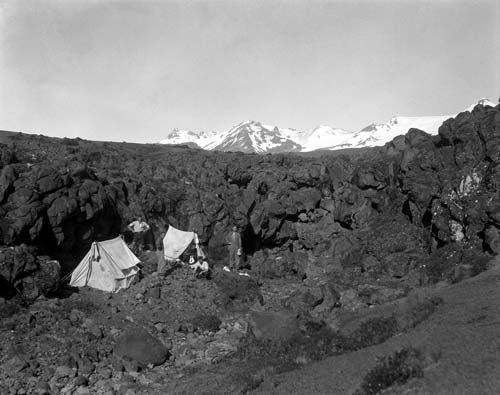
Photographed in the summer of 1928–29, this geological field camp is set among lava flows on the flanks of Mt Ruapehu. Geologist Les Grange sits in the entrance to the tent on the right hand side. From 1926 to 1929 Grange made a detailed survey of the volcanic region between Rotorua and Ohakune, and his maps are still a source of useful information.
Using this item
GNS Science
Reference:
7175a
Permission of GNS Science must be obtained before any use of this image.
Add new comment