


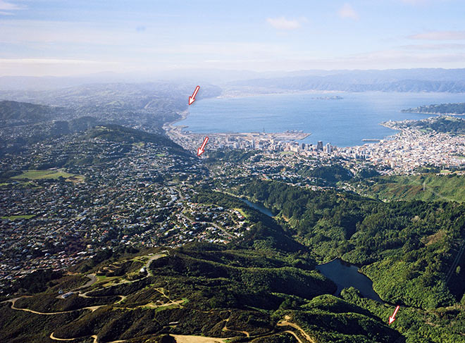
This view of the Wellington Fault looks north across Wellington City and the harbour, with the suburb of Karori in the left foreground. The fault passes northwards through the suburbs of Kelburn and Thorndon, and then forms the western edge of Wellington Harbour and the Hutt Valley in the distance. A stream that flows along the edge of the fault was dammed in two places to create reservoirs – the two lakes visible in the right foreground. These supplied water to Wellington for many years. Now that the fault is recognised as a hazard, an alternative water source has been found, and the lakes have become part of the Zealandia wildlife reserve.
Using this item
GNS Science
Reference:
CN17492
Photograph by Lloyd Homer
Permission of GNS Science must be obtained before any use of this image.
Add new comment