


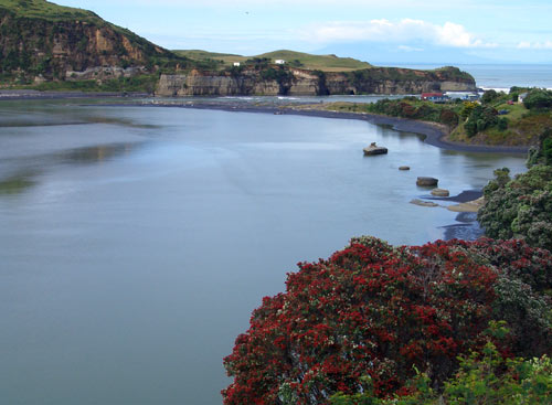
The Mōkau River has been central to life for those living in this area for centuries. It has been a source of food and income – as well as a major transport route – for both Māori and Pākehā, and is the traditional boundary between the Taranaki and Tainui peoples. This is the coastal end of the river, with the mouth visible at top right.
Using this item
Flickr: Shadowfoot's photostream
Photograph by Brian Logan
This item has been provided for private study purposes (such as school projects, family and local history research) and any published reproduction (print or electronic) may infringe copyright law. It is the responsibility of the user of any material to obtain clearance from the copyright holder.

Add new comment