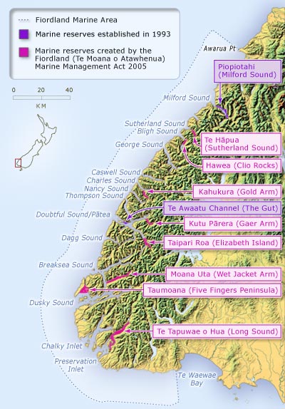
The Fiordland Marine Area is a special management area in the south-west of the South Island. Stretching from Awarua Point in the north to the eastern bank of the Waiau River in the south, the area totals 928,000 hectares and extends 22 kilometres into the Tasman Sea. The area includes the waters of the 14 fiords (originally called sounds or inlets) and 10 marine reserves.
Using this item
Te Ara - The Encyclopedia of New Zealand
This item has been provided for private study purposes (such as school projects, family and local history research) and any published reproduction (print or electronic) may infringe copyright law. It is the responsibility of the user of any material to obtain clearance from the copyright holder.
Source: Ministry for the Environment


Add new comment