


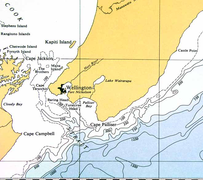
This portion of a New Zealand Oceanographic Institute chart is derived from the work of oceanographers Jim Brodie and Henry Pantin. The bathymetry was determined by New Zealand Oceanographic Institute soundings and from admiralty records. Before the days of multibeam echo sounders, charts gave only a vague impression of the shape of the sea floor.
Using this item
Te Ara - The Encyclopedia of New Zealand
This item has been provided for private study purposes (such as school projects, family and local history research) and any published reproduction (print or electronic) may infringe copyright law. It is the responsibility of the user of any material to obtain clearance from the copyright holder.
Source: J. W. Brodie and H. Pantin, New Zealand, North Island, bathymetry. Wellington: New Zealand Oceanographic Institute, 1960.

Add new comment