


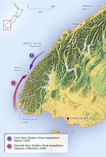
This map shows the areas covered by the voyages of the New Golden Hind in 1945–46. Although the distance does not seem large, each of the fiords was explored in detail. Gillespies Beach, where slightly radioactive dredge concentrates were examined, is at the top.
Using this item
Te Ara - The Encyclopedia of New Zealand
This item has been provided for private study purposes (such as school projects, family and local history research) and any published reproduction (print or electronic) may infringe copyright law. It is the responsibility of the user of any material to obtain clearance from the copyright holder.
Add new comment