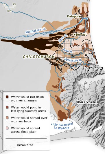
The settlement of Christchurch was built on the flood plain of the Waimakariri River. The earliest stopbanks were built in the 1860s. Despite these, Christchurch has sometimes been flooded when heavy rainfall in the mountains has caused the river to rise. This map shows what would happen in sequence if floodwaters breached the stopbanks.
Using this item
Te Ara – The Encyclopedia of New Zealand
This item has been provided for private study purposes (such as school projects, family and local history research) and any published reproduction (print or electronic) may infringe copyright law. It is the responsibility of the user of any material to obtain clearance from the copyright holder.


Add new comment