


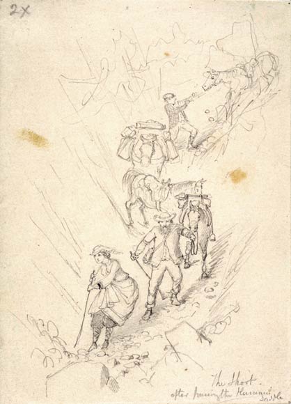
Until 1866, when Nicholas Chevalier drew this sketch, Harper Pass was the main route from Canterbury to the West Coast. In that year, a road over Arthur’s Pass was finished and Harper Pass was used only by keen trampers. Arthur’s Pass was more direct, while Harper Pass had some steep sections, shown in this sketch of the artist and his wife coming down from the pass. The drawing is titled ‘The shoot after passing the Hurunui Saddle’, an alternative name for the pass. The Hurunui River was the route to the pass from the Canterbury side.
Using this item
Alexander Turnbull Library
Reference:
A-102-029
Pencil sketch by Nicholas Chevalier
Permission of the Alexander Turnbull Library, National Library of New Zealand, Te Puna Mātauranga o Aotearoa, must be obtained before any re-use of this image.
Add new comment