


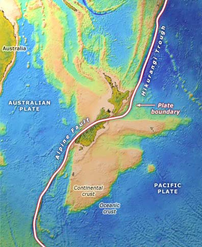
The land area of New Zealand is a small part of a largely submerged continental fragment that drifted away from Australia. In this diagram, continental crust is shown in orange, and thinner oceanic crust is blue. New Zealand lies at the junction between the Pacific and Australian plates, indicated as a broad line on the image. The plates are pushing against each other, causing uplift of the present land area.
Te whakamahi i tēnei tūemi
Te Ara - The Encyclopedia of New Zealand
This item has been provided for private study purposes (such as school projects, family and local history research) and any published reproduction (print or electronic) may infringe copyright law. It is the responsibility of the user of any material to obtain clearance from the copyright holder.
Source: Ray Wood and others, New Zealand’s continental shelf and UNCLOS Article 76. Lower Hutt: Institute of Geological and Nuclear Sciences; Wellington: National Institute of Water and Atmospheric Research, 2003
Tāpiritia te tākupu hou