


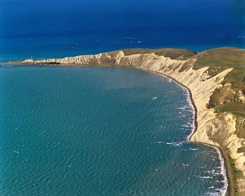
The distinctive cliffs of Cape Campbell stretch around Clifford Bay, with the lighthouse (first installed in 1870) visible on the furthest headland. The bay opens into Cook Strait. South of the cape, the eastern coast of the South Island turns sharply south-west, following the general alignment of fault lines that have shaped much of the terrain.
Using this item
GNS Science
Reference:
27527/10
Photograph by Lloyd Homer
Permission of GNS Science must be obtained before any use of this image.

Add new comment