


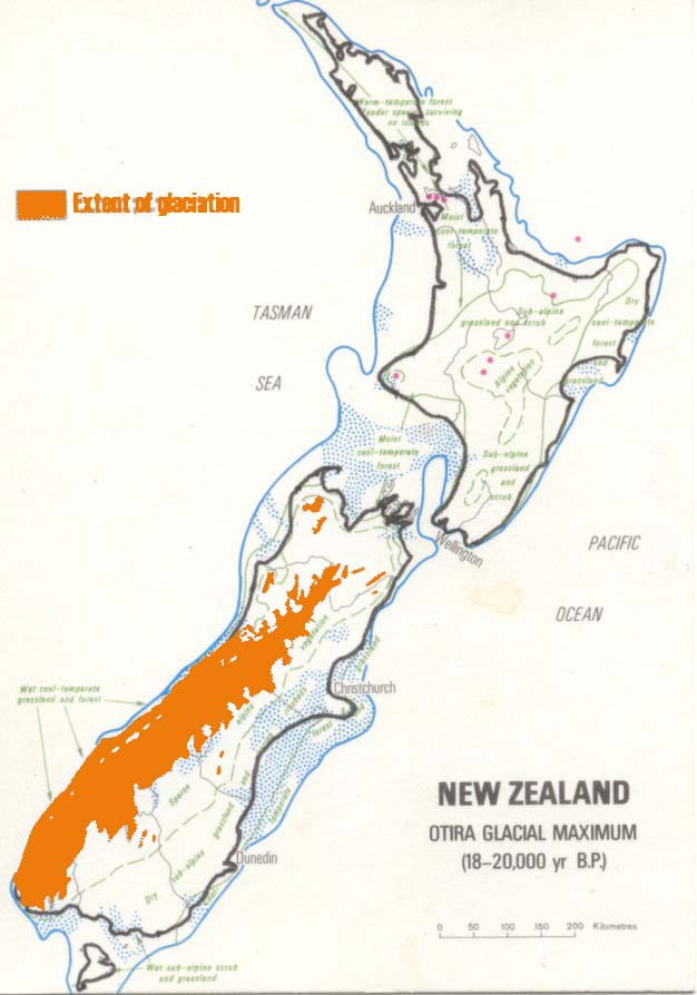
This map is a reconstruction of the New Zealand coastline 20,000 to 18,000 years ago, during the last glacial period. The sea level was about 100 metres lower than at present, so the shallower part of the continental shelf was exposed. Cook Strait did not exist, and it would have been possible to walk the length of the country. Glacier ice was more extensive that it is now, and large glaciers extended out beyond the present coastline on the western side of the South Island. Major rivers carried huge loads of sediment all the way to the edge of the continental shelf. The Waikato River originally flowed north and entered the sea on the eastern side of the North Island (shown by a dashed line). About 20,000 years ago it changed to its present course.
Using this item
Te Ara - The Encyclopedia of New Zealand
This item has been provided for private study purposes (such as school projects, family and local history research) and any published reproduction (print or electronic) may infringe copyright law. It is the responsibility of the user of any material to obtain clearance from the copyright holder.
Source: GNS Science

Add new comment