


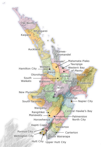
This map shows the district and city council boundaries in the North Island. In 1989 local-government reform greatly reduced the number of local bodies in New Zealand. Small counties and boroughs disappeared, along with ad hoc bodies like drainage and transport boards. The country was divided along more rational lines into cities and districts. In 2010 a single Auckland Council replaced the seven city and district councils that had previously covered the Auckland region.
Using this item
Te Ara - The Encyclopedia of New Zealand
This item has been provided for private study purposes (such as school projects, family and local history research) and any published reproduction (print or electronic) may infringe copyright law. It is the responsibility of the user of any material to obtain clearance from the copyright holder.

Add new comment