


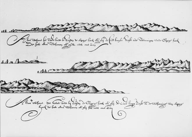
New Zealand was first seen by European eyes when Abel Tasman came upon the west coast of the South Island. One of Tasman’s associates, Isaac Gilsemans, sketched the coast from just north of Punakaiki up to Rocky Point (today’s Cape Foulwind). These sketches are the first European representation of New Zealand. The script on the map refers to Staten Landt, the name Tasman gave to the country.
Using this item
Alexander Turnbull Library
Reference:
PUBL-0086-019
Photolithograph after a drawing by Isaac Gilsemans
Permission of the Alexander Turnbull Library, National Library of New Zealand, Te Puna Mātauranga o Aotearoa, must be obtained before any re-use of this image.
Add new comment