


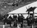
In the 1860s most of Manawatū passed from Māori to Crown ownership. This map, from Buick’s Old Manawatu, published in 1903, shows some of the principal blocks. There were years of litigation about the purchase of the Rangitikei–Manawatū block, which lay between the Rangitīkei and Ōroua rivers.
Te whakamahi i tēnei tūemi
Te Ara - The Encyclopedia of New Zealand
Reference:
Thomas Lindsay Buick, Old Manawatu. Palmerston North: Buick and Young, 1903, facing p. 168
This item has been provided for private study purposes (such as school projects, family and local history research) and any published reproduction (print or electronic) may infringe copyright law. It is the responsibility of the user of any material to obtain clearance from the copyright holder.

Tāpiritia te tākupu hou