


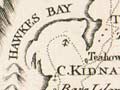
This mid-19th century map of New Zealand shows a variety of names for the main islands – the North Island had also been named New Ulster, the Middle (now South) Island New Munster and South (now Stewart) Island, New Leinster. The New Ulster, Munster and Leinster names, the first two of which were also used for provincial divisions, fell out of use when new provinces with different names were established in 1853.
Te whakamahi i tēnei tūemi
Alexander Turnbull Library
Reference:
MapColl 830a/[ca.1852]/Acc.296
Permission of the Alexander Turnbull Library, National Library of New Zealand, Te Puna Mātauranga o Aotearoa, must be obtained before any re-use of this image.

Tāpiritia te tākupu hou