


")

 ash cloud, 2019")
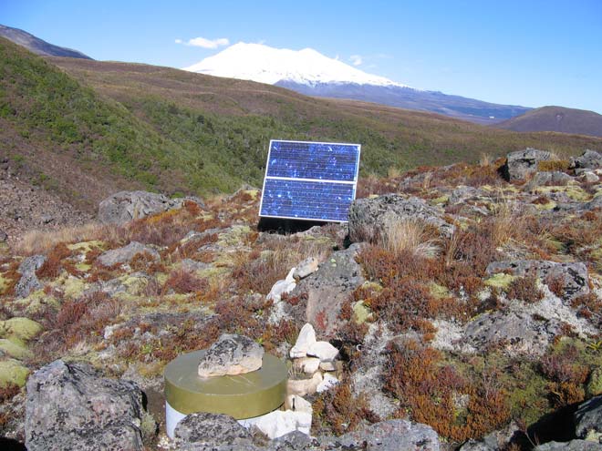
Increasing earthquake activity is one of the signs of magma (molten rock within the earth) moving up to the surface. There is a network of seismographs, which measure earthquake activity, at sites where volcanic eruptions are likely. A protective box surrounds this seismograph (foreground) in a remote part of Tongariro National Park, with Ruapehu in the background. The results are telemetered to GeoNet headquarters, where any changes in activity are monitored. Power is provided by a solar panel (centre).
Te whakamahi i tēnei tūemi
Permission of GNS Science must be obtained before any use of this image.
Tāpiritia te tākupu hou