Kōrero: Earthquakes

GPS station in the Southern Alps

GPS station in the Southern Alps

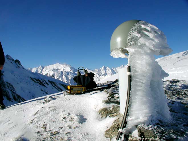
Global positioning system (GPS) equipment is used to pinpoint where strain is building up in the earth’s crust. Stations like this one high in the Southern Alps need to be robust to withstand the extreme climate.

Te whakamahi i tēnei tūemi

GNS Science
Photograph by Dion Matheson

Permission of GNS Science must be obtained before any use of this image.

Ngā whakaahua me ngā rauemi katoa o tēnei kōrero

Te tuhi tohutoro mō tēnei whārangi:

Eileen McSaveney, 'Earthquakes - Living with earthquakes', Te Ara - the Encyclopedia of New Zealand, http://www.TeAra.govt.nz/mi/photograph/4419/gps-station-in-the-southern-alps (accessed 6 May 2024)

He kōrero nā Eileen McSaveney, i tāngia i te 12 Jun 2006, reviewed & revised 1 Aug 2017