


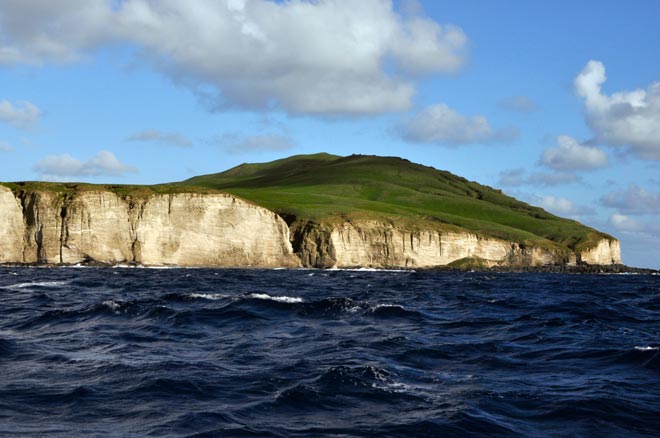
The cliffs surrounding Macauley Island are seen here from the north-east. The main part of the island is a volcanic cone, right, which has been largely eroded away. A huge ignimbrite eruption about 6,300 years ago formed the white pumice cliffs. A younger, dark-coloured basalt lava flow filled a valley eroded in the pumice (centre). This – one of the few places where it is possible to climb up the cliffs – was the site of the castaway depot.
Te whakamahi i tēnei tūemi
Kermadec Expedition
Photograph by Malcolm Francis
This item has been provided for private study purposes (such as school projects, family and local history research) and any published reproduction (print or electronic) may infringe copyright law. It is the responsibility of the user of any material to obtain clearance from the copyright holder.
Tāpiritia te tākupu hou