


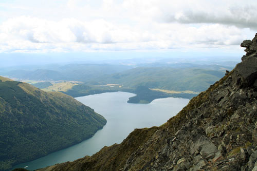
Lake Rotoiti is a small glacial lake near St Arnaud, on the edge of the Southern Alps. The lake was filled by a glacier at the end of the last ice age, about 15,000 years ago. As temperatures warmed the ice melted, and the depression was filled with water. While exploring the area in 1859, Ferdinand Hochstetter noticed evidence for past glaciation – terminal moraines that marked the former extent of glacier ice.
Te whakamahi i tēnei tūemi
Te Ara - The Encyclopedia of New Zealand
Photograph by Jock Phillips
This item has been provided for private study purposes (such as school projects, family and local history research) and any published reproduction (print or electronic) may infringe copyright law. It is the responsibility of the user of any material to obtain clearance from the copyright holder.

Tāpiritia te tākupu hou