


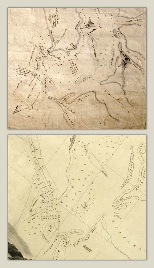
The difficulties faced by mariners navigating around the New Zealand coasts in the 1830s can be seen in these details of two charts, both prepared about 1836–37. They each attempt to chart the sand bars at the entrance to Kaipara Harbour, yet the positions and shape of the sand bars vary considerably. Little wonder that the captain of the Sophia Pate was confused when he tried to negotiate a safe passage in 1841. The brig became stuck on a sand bank.
Te whakamahi i tēnei tūemi
Alexander Turnbull Library
Reference:
MapColl-832.11aj/1837/Acc.24214 (top); MapColl-832.1aj/1836?/565 (bottom)
Permission of the Alexander Turnbull Library, National Library of New Zealand, Te Puna Mātauranga o Aotearoa, must be obtained before any re-use of this image.

Tāpiritia te tākupu hou