


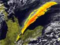
These maps show the extent and thickness of the three largest ash falls from the Ruapehu eruptions in 1995–96. Thickness is measured in millimetres.
Te whakamahi i tēnei tūemi
Te Ara - The Encyclopedia of New Zealand
This item has been provided for private study purposes (such as school projects, family and local history research) and any published reproduction (print or electronic) may infringe copyright law. It is the responsibility of the user of any material to obtain clearance from the copyright holder.
Source: GNS Science

Tāpiritia te tākupu hou