


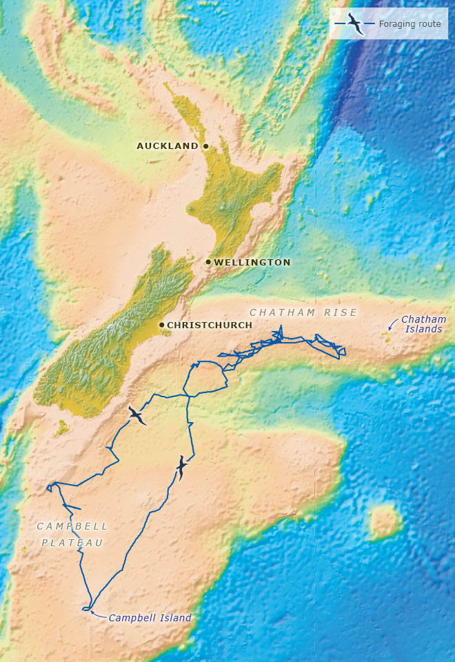
Some seabirds travel great distances from their nests in search of food. This is the track taken by a southern royal albatross (given the name Princess Anne) from her nest on Campbell Island to the Chatham Rise. Information about her movements was supplied by a tiny satellite transmitter and a recorder fitted to her body. She travelled for almost 16 days, while her mate took his turn sitting on the egg. She covered the first 900 kilometres in 24 hours – an average rate of 37.5 kilometres per hour. Her furthest point from the colony was 1,200 kilometres, but she flew a total of 6,000. Just over half of her time was spent in flight; she sat on the water for the remainder.
Te whakamahi i tēnei tūemi
Te Ara – The Encyclopedia of New Zealand
This item has been provided for private study purposes (such as school projects, family and local history research) and any published reproduction (print or electronic) may infringe copyright law. It is the responsibility of the user of any material to obtain clearance from the copyright holder.
Base map courtesy of GNS Science; Data: C. Troup, ‘Foraging strategies of southern royal albatrosses.’ M.Appl.Sc thesis, Lincoln University, 2004
Tāpiritia te tākupu hou