


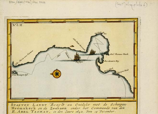
When Abel Tasman sailed away from New Zealand, he had mapped only an enigmatic line, which might or might not have been the western coast of a great unknown continent. This Dutch map of 1726 shows the coast of what Tasman called Staten Landt.
Te whakamahi i tēnei tūemi
Alexander Turnbull Library
Reference:
MapColl-830a/1642(1726)/Acc.32129
Permission of the Alexander Turnbull Library, National Library of New Zealand, Te Puna Mātauranga o Aotearoa, must be obtained before any re-use of this image.

Tāpiritia te tākupu hou