


")


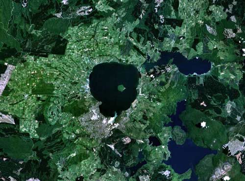
This NASA image shows the teardrop-shaped Lake Rotorua, with Mokoia Island near the middle and Rotorua city on its southern shore. The lake is in a caldera – a depression formed by a volcanic eruption. Lakes Tarawera, Okataina and Okareka occupy the Okataina caldera. The even mass of the Haroharo lava flow abuts Lakes Okataina and Tarawera, and the craters of Mt Tarawera are at bottom right.
Using this item
This item has been provided for private study purposes (such as school projects, family and local history research) and any published reproduction (print or electronic) may infringe copyright law. It is the responsibility of the user of any material to obtain clearance from the copyright holder.

Add new comment