Bay of Islands
Expanse of water with several long inlets and over 150 islands, south of Whangaroa Harbour. It formed when the sea drowned a number of river valleys, creating an irregular and attractive coastline of more than 800 km. The area shows signs of volcanic activity, with many eruption outlets and lava flows. Its outer limits are marked by the headlands of Tokerau on the north and Rākaumangamanga on the south.
A number of hapū (sub-tribes), with Ngāpuhi and/or Ngāti Hine affiliations, have a lengthy association with the bay. It was first visited by the ancestral navigators Kupe and Ngake (or Ngahue), and later Toikairākau.
European arrivals
The first European visitor, in 1769, was Lieutenant James Cook, who named the bay. In 1772 the French navigator Marion du Fresne arrived. After a series of misunderstandings he was killed with 24 of his crew. In revenge the French destroyed three Māori villages and massacred around 250 people.
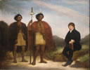
The next encounter was more peaceful. In December 1814 Anglican missionary Samuel Marsden arrived from New South Wales and preached the first Christian sermon on Christmas Day. The next year he established a mission station at Rangihoua Bay. Others were set up at Kerikeri (1819) and Paihia (1823). The bay was chosen for these missions because it was one of the first reached from Sydney, and had safer anchorages than the west coast. But Marsden’s contact with travelling Māori before he came to New Zealand, notably Te Pahi and Ruatara of Ngāpuhi, probably also influenced his choice.
Through the later 1820s and 1830s whalers favoured the bay for provisioning, bringing trading opportunities for which Māori competed vigorously. Whaling was concentrated at Kororāreka (now Russell), across the water from Paihia.
The Treaty of Waitangi
A British Resident, James Busby, arrived in 1833. He lived at Waitangi, adjacent to Paihia. The signing of the Treaty of Waitangi between the British Crown and Māori chiefs took place at the Bay of Islands in 1840, and it became the first seat of colonial government. It was also the first site of conflict between the Crown and Māori, in 1845, after some Māori were angered by the shift in government (and therefore commerce and influence) to Auckland in 1841.
Economic change
For the next 80 or so years the bay slumbered. Trade in kauri and kauri gum was the principal economic activity for both Māori and Pākehā. In the 1920s American adventurer and author Zane Grey made his base at Otehei Bay on Urupukapuka Island and popularised the bay’s deep-sea fishing.
The ‘cream trip’
In 1920 a launch service began collecting cream from dairy farms on the small islands in the Bay of Islands. For many years it also dropped off mail and supplies. Sightseers hitched a ride, and in time the experience was so sought-after that the run became a daily commercial tour. A fleet of boats now offer the trip.
First the railway, then the highway brought the bay within the reach of Auckland holidaymakers, who double the population of the district every year between Christmas and the end of January. Many cruising yachts make the township of Ōpua a first port of call on arrival from further north, and more than 50 cruise ships call in to the Bay each year. In 1978 the Bay of Islands Maritime and Historic Park was established to promote the area’s recreational attractions and protect its special character.

