


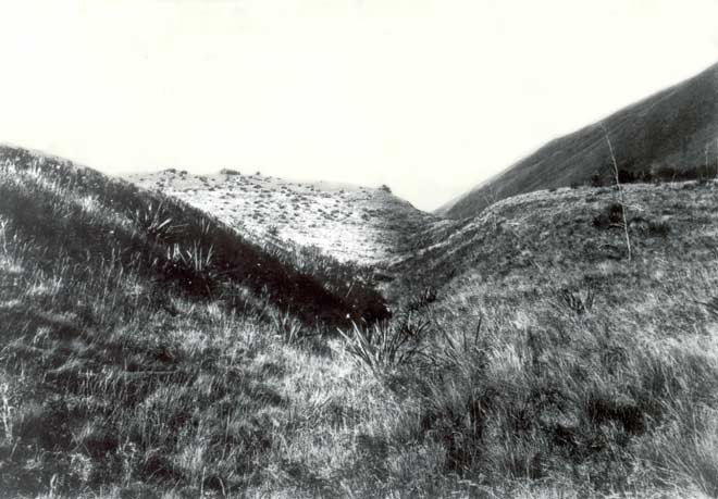
This view of the Awatere Fault looks south-east at the back of Altimarloch Station. It was taken in 1888 by geologist Alexander McKay 40 years after the 1848 earthquake, when the fault ruptured. The vegetation has regrown, but the offset of the land surface is quite clear. McKay’s observations in 1888 were fundamental in clarifying the relationship between earthquakes and faulting.
Using this item
GNS Science
Reference:
4895
Photograph by Alexander McKay
Permission of GNS Science must be obtained before any use of this image.
Add new comment