


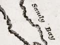
Captain Thomas Wing, master of the schooner Fanny, drew this 1836 chart. He charted several North Island harbours from 1835 to 1844, while working for the traders Clendon and Stephenson. The sandbars that still make the Kaipara Harbour difficult to enter are clearly depicted. The text notes that the tidal currents were very strong, particularly on an ebb (outgoing) tide and that entry should only be attempted at slack water or flood (incoming) tide.
Using this item
Auckland City Libraries - Tāmaki Pātaka Kōrero
Reference:
NZ Map 4613
Permission of Auckland City Libraries Tāmaki Pātaka Kōrero must be obtained before any re-use of this image.

Add new comment