


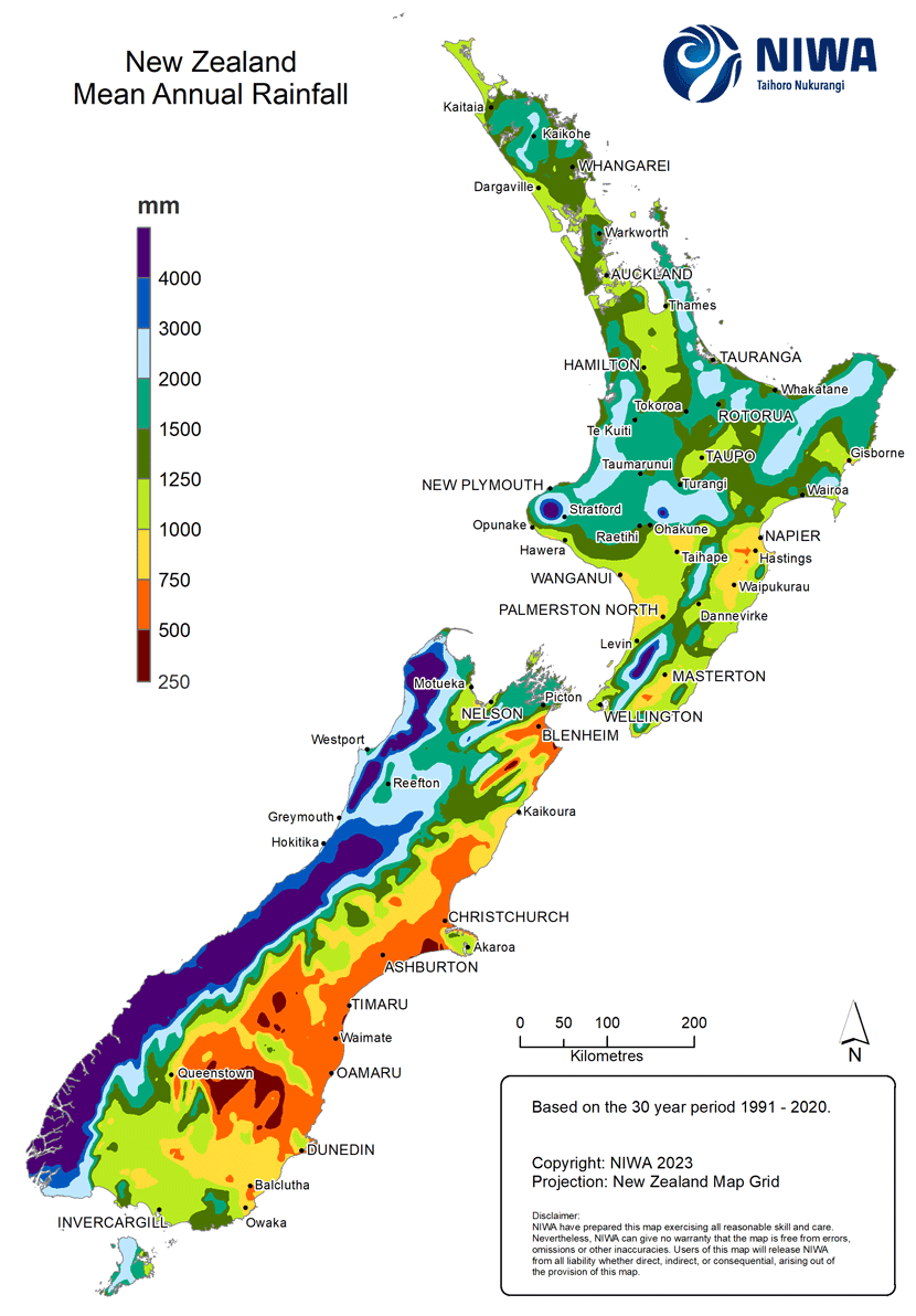
This map shows the mean annual rainfall around New Zealand, measured over a 30-year period. The South Island has both the wettest and the driest parts of the country within 100 kilometres. Highest rainfall occurs along a narrow zone over the Southern Alps, as well over mountains in north-west Nelson and scattered mountainous areas in the North Island.
Te whakamahi i tēnei tūemi
NIWA – National Institute of Water and Atmospheric Research
This item has been provided for private study purposes (such as school projects, family and local history research) and any published reproduction (print or electronic) may infringe copyright law. It is the responsibility of the user of any material to obtain clearance from the copyright holder.
Tāpiritia te tākupu hou