

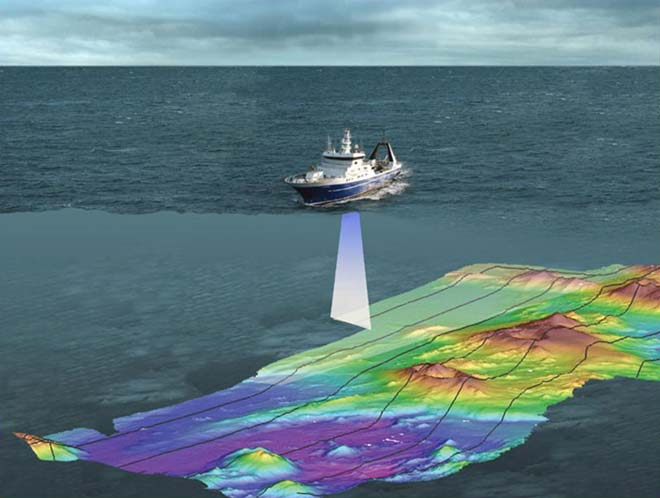
This image shows the research ship Tangaroa and an artist's depiction of the beam of sound waves mapping the ocean floor. Multibeam surveying provides incredibly detailed imagery of the seabed. On board survey ships, instruments emit multiple beams of sound waves, which are reflected off the ocean floor. As the sound waves bounce back with different strengths and timing, computers analyse these differences to determine the depth and shape of the sea floor, and whether the bottom is rock, sand or mud.
Using this item
NIWA – National Institute of Water and Atmospheric Research
This item has been provided for private study purposes (such as school projects, family and local history research) and any published reproduction (print or electronic) may infringe copyright law. It is the responsibility of the user of any material to obtain clearance from the copyright holder.


Add new comment