


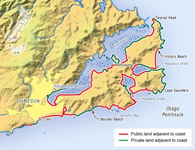
The widely-held belief in a Queen’s chain providing universal access to the coast above the high water mark is largely a myth. In this map of the water margins along Otago Peninsula, the public land represents 66.71 kilometres or 61.6% of the coastal strip. The rest is in private ownership. Even in the publicly-owned land, 32.19 kilometres (29.8% of the total) have restrictions, such as a sea wall, or steep topography, which make access impossible.
Using this item
Te Ara – The Encyclopedia of New Zealand
This item has been provided for private study purposes (such as school projects, family and local history research) and any published reproduction (print or electronic) may infringe copyright law. It is the responsibility of the user of any material to obtain clearance from the copyright holder.
Source: E. L. Clark and M. J. Hilton, ‘Measuring and reporting changing public access to and along the coast.’ New Zealand Geographer 59, no. 1 (2003): 7


Add new comment