


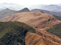
A geological map illustrates the rocks exposed at the surface of the earth. Different rock types are shown by different colours. This map, produced by GNS Science in 2004, summarises observations made over 150 years of exploration and research. You can zoom in to look closely at particular areas of the map.
Important features include:
Greywacke (blue), forming the main mountain ranges. In the south of the South Island the greywacke has been deeply buried and metamorphosed in schist (purple).
The Alpine Fault, which cuts obliquely across the South Island.
Volcanic rocks, mainly ignimbrite (red) which has erupted from the Taupō Volcanic Zone in the centre of the North Island.
Using this item
Permission of GNS Science must be obtained before any use of this image.
Add new comment