

 and City")

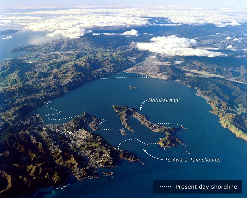
This aerial view of Wellington has been modified to show the shoreline as it was before the Haowhenua earthquake, probably in the 15th century. At this time, Miramar Peninsula was an island called Motukairangi, although the water covering the airport (Te Awa-a-Tia channel) would have been very shallow. The present-day coastline is indicated by a dashed line.
Te whakamahi i tēnei tūemi
GNS Science
Reference:
CN15244/24
Photograph by Lloyd Homer
Permission of GNS Science must be obtained before any use of this image.


Tukunga
This is on the GSN website,
Lisamarie Anders (not verified)
06 o Māehe 2011
Tāpiritia te tākupu hou