

")


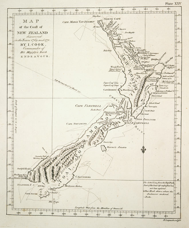
Drawn by Lieutenant James Cook in 1770, this is easily recognisable as New Zealand. It was the first complete chart of the country’s coastline, and is remarkably accurate and incredibly detailed. Although some people like to dwell on Cook’s errors (Banks Peninsula is shown as an island, and Stewart Island is connected to the mainland), his precision and scientific approach set the standards for the work of the British Admiralty, which published its first official charts in 1800.
Te whakamahi i tēnei tūemi
Alexander Turnbull Library
Reference:
PUBL-0037-25
Permission of the Alexander Turnbull Library, National Library of New Zealand, Te Puna Mātauranga o Aotearoa, must be obtained before any re-use of this image.

Tukunga
Was this map drawn by Captain
Mitchell (not verified)
07 o Āpereira 2014
Tāpiritia te tākupu hou