


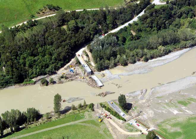
The bridge across the Pohangina River, Manawatū, was destroyed by flood water in February 2004. The gas main to Hawke’s Bay crossed the bridge, so the gas flow was disrupted as well as access to the Pohangina Valley. When this photograph was taken, the river had receded from its peak but still contained a high mud content from the sediment washed off the surrounding hills.
Using this item
GNS Science
Reference:
GH 1817
Photograph by Graham Hancox
Permission of GNS Science must be obtained before any use of this image.

Add new comment