


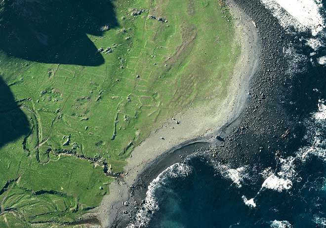
This aerial photograph, by archaeologist Kevin L. Jones, shows archaeological evidence of Māori garden plots at Pukaroro on the Wairarapa coast. The contours on the site are stone rows, used to mark out the gardens, which date from before the first European explorers visited New Zealand. Aerial photography has proven a valuable tool for discovery and identification of archaeological sites around New Zealand and Jones has been one of the most important archaeological photographers.
Using this item
Department of Conservation
Reference:
10051768
Photograph by Kevin Jones
This item has been provided for private study purposes (such as school projects, family and local history research) and any published reproduction (print or electronic) may infringe copyright law. It is the responsibility of the user of any material to obtain clearance from the copyright holder.

Add new comment