


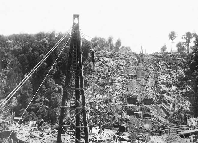
The section of the main trunk line south of Taumarunui runs across a number of ravines, which have been spanned by viaducts. This photograph shows the foundations for the Makatote viaduct being laid in 1906. At the time it was built, this viaduct was the highest in New Zealand and one of the highest in the world. There are viewing areas at a rest stop between Erua and Pōkākā, and at the Makatote Scenic Reserve at the viaduct's northern end.
Using this item
Abundant Past, Anderson Collection
Reference:
11371
This item has been provided for private study purposes (such as school projects, family and local history research) and any published reproduction (print or electronic) may infringe copyright law. It is the responsibility of the user of any material to obtain clearance from the copyright holder.
Add new comment