


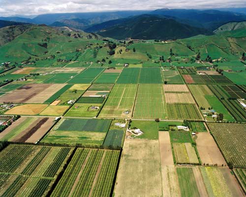
This aerial view of the Waimea Plains, south of Nelson, looks towards the Richmond Range. The rich, intensively cropped river soils of the plains have historically been used for farming and horticulture. In the early 2000s there were fewer sheep and beef cattle, and grapes, kiwifruit and olives were the typical crops. Future horticultural and agricultural intensification will depend largely on the availability of water. A dam is planned in the Lee River catchment to help meet this demand.
Using this item
GNS Science
Reference:
24235/25
Photograph by Lloyd Homer
Permission of GNS Science must be obtained before any use of this image.

Add new comment