


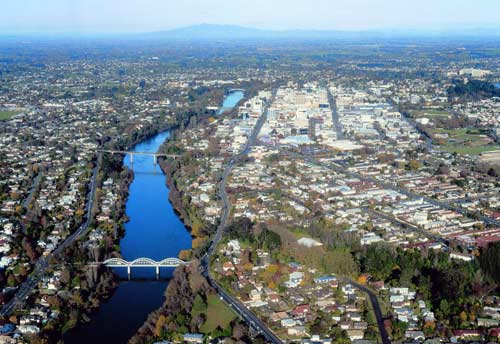
This aerial photograph of Hamilton looking up the Waikato River with the Fairfield Bridge in the foreground shows the business district on the right, and central suburbs on both river banks. Post-war growth led to the development of more suburbs on the outskirts of the city.
Using this item
This item has been provided for private study purposes (such as school projects, family and local history research) and any published reproduction (print or electronic) may infringe copyright law. It is the responsibility of the user of any material to obtain clearance from the copyright holder.


Add new comment