


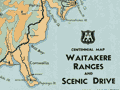
This brochure, published by the Newman’s bus company in 1931, shows the North Island surrounded by images of the main tourist attractions. The heavy blue line indicates the route taken by Newman’s buses. Rail and bus transport companies, and the government’s Department of Tourist and Health Resorts, published numerous maps to encourage New Zealanders and visitors to travel around the country. They showed the routes to and from tourist destinations and included pictures and descriptions of scenic attractions.
Using this item
Alexander Turnbull Library
Reference:
Eph-C-TOURISM-North-Island-1931-01
Permission of the Alexander Turnbull Library, National Library of New Zealand, Te Puna Mātauranga o Aotearoa, must be obtained before any re-use of this image.
Add new comment