


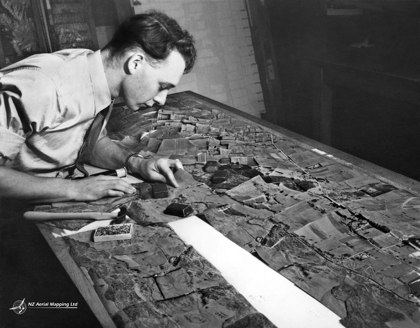
A staff member of New Zealand Aerial Mapping is seen here compiling a mosaic from aerial photographs, around 1957. The photos were overlapped and cut to minimise distortion. Once completed, the mosaic could be re-photographed as a whole and printed for sale.
Using this item
NZ Aerial Mapping
Reference:
19/198
Photograph by Paul Steeds
This item has been provided for private study purposes (such as school projects, family and local history research) and any published reproduction (print or electronic) may infringe copyright law. It is the responsibility of the user of any material to obtain clearance from the copyright holder.

Add new comment